Icy Conditions Cause Major Traffic Backups
DETROIT (WWJ) - Freezing rain and drizzle that moved into the area early Friday caused treacherous driving conditions for morning commuters.
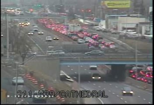
Icy conditions and numerous pile-ups were reported, leading to several freeway closures. Although the list of road closures diminished as the morning wound down, drivers still had to deal with backups, accidents and slow-moving traffic.
Click here to view the latest traffic incidents
Some police departments had trouble keeping up with the number of accidents. Dispatchers asked for help, but officers were not available due to the high number of wrecks.
Michigan State Police Department confirmed at least one fatality on I-75 near East Warren due to an accident that involved a vehicle smashing into the back of a semi-truck.
"It's the worst morning I think I've seen," said WWJ' Traffic Reporter John Bailey. "I don't recall a day with so many closures."
Several traffic tipsters called in and described surface streets as a "sheet of ice." Callers also reported rollovers, spin-outs and even car fires.
"I'm on Southfield Freeway and it (looks like) I pretty much just drove through a junkyard," said one tipster.
Echoing that statement, WWJ's Bill Szumanski was also on Southfield Freeway. "Sixteen cars in a one-half mile stretch...most of them are either sideways, up the embankment or sitting over on this little pile of snow," he said.
Here is what some other traffic tipsters had to say:
- "I-96 at Kent Lake Road... it's like a demolition derby out here."
- "Southbound 23 before M-36... I've been crawling for 20 minutes going about two to five miles per hour."
- "I-96, one mile east and west of I-94 is a skating rink, about a dozen cars on the shoulder."
- "Interchange from 275 to 696 Eastbound... there's a SUV that rolled and is sitting on its roof."
- "Southbound Rochester Road, north of 16 Mile there's a jack-knifed semi and a 25 car pileup."
- "I-75 at Crooks Road... there's a car in the ditch about every 100 feet."
- "Northbound M-39 at Michigan... it's a solid sheet of ice."
- "Southbound on Southfield, just past Ford Road there's got to be 20 or 30 cars all over the place. Northbound there's a car on fire. It is a wreck out here."
Oakland County Road Commission spokesman Craig Bryson said they were tackling the problems as quickly as they could.
"We got about 60 out right now. We'll be increasing that as more drivers come in," said Bryson. "We did do some anti-icing where we had trucks out before it started, spraying salt brine on some of the roads."
Stay with WWJ Newsradio 950 for the latest, during Traffic and Weather on the 8s, 24 hours a day.
- Latest Traffic Incidents - - Check for School Closings –
Here's the forecast:
Friday - Cloudy. Freezing rain with a chance of light sleet through 11 a.m., then rain. Light glazing expected. Highs 40 to 44. South winds 5 to 15 mph. Chance of precipitation 100 percent.
Friday Night - Cloudy. Rain heavy at times with a chance of thunderstorms. Lows 39 to 43. South winds 10 to 15 mph. Chance of rain 100 percent.
Saturday - Cloudy. Rain through early afternoon...then rain likely with a chance of snow. Highs 41 to 45. South winds 10 to 15 mph...turning to west late. Chance of precipitation 100 percent.
Saturday Night - Cloudy. Rain and snow showers likely mainly before midnight...then a chance of snow showers. Accumulations less than an inch likely. Lows 23 to 27. North winds 10 to 15 mph. Chance of precipitation 60 percent.
Sunday - Cloudy during the morning. Partly sunny during the afternoon. Highs 32 to 36. North winds 10 to 15 mph.
Sunday Night - Partly cloudy early...then becoming mostly clear. Lows 16 to 20.
More on our Weather Page.