Bitterly Cold Weather Moves Into Metro Detroit
DETROIT (WWJ/AP) - Another round of bitter cold is moving into Michigan as parts of the state dig out from record-breaking snowfall.
With the wind chill expected to fall well below zero in metro Detroit overnight, it'll be decision time once again for local school district. A number of districts, Thursday afternoon, told WWJ they'll wait it out a bit before calling school off for Friday.
[SCHOOL CLOSINGS: Check The List]
Forecasters say highs will only reach into the 20s on Thursday before the temperature plunges. The National Weather Service warns of wind chill temperatures 20 to 25 degrees below zero statewide into Friday. The cold snap is sticking around for the weekend as well, and forecasters say we could even see a few more inches of snow.
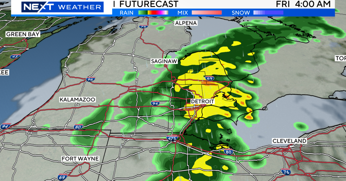
The cold comes after more than 8 inches of snow fell on parts of southern Michigan. Schools were closed Thursday for a second consecutive day in Monroe County, which was hit hard by the snowstorm.
The weather service said 7.6 inches of snow fell Wednesday at Detroit Metropolitan Airport in Romulus, breaking a record of 5 inches set back on Feb. 5, 1908. The snow was so intense at times that three jetliners became stuck while taxiing to runways. Airport Spokesman Mike Conway said two planes with 50 to 70 passengers each were freed from the snow by tug trucks, while the pilot of a third jet was able to free the aircraft before help arrived.
Other cities in the metro Detroit area reported anywhere from 4 to 9 inches of snow on Wednesday, forcing many to declare a snow emergency.
Here's the local forecast from the CBS Detroit weather team:
Thursday: Frigid with times of clouds and sun. Winds SW at 10 to 20 mph. High 20F.
Thursday Night: Partly cloudy and bitterly cold; extreme cold can be dangerous for outdoor activities late. Winds WSW at 10 to 20 mph. Lows around 0F.
Friday: Partly sunny, brisk and bitterly cold. Winds SW at 10 to 20 mph. High 15F.
Friday Night: Mostly cloudy and frigid. Winds SW at 10 to 15 mph. Low -1F.
Saturday: Mostly cloudy and very cold; a chance for a bit of snow or flurries in the afternoon. Winds S at 5 to 10 mph. High 18F.
Saturday Night: Light snow in the evening, tapering to a few snow showers overnight. Accumulation around 1 inch. Winds SW at 5 to 10 mph. Low 12F.
Sunday: Mostly cloudy and very cold with a chance for a bit of snow or flurries. Winds W at 5 to 10 mph. High 21F.
Sunday Night: Partly cloudy and frigid. Winds W at 5 to 10 mph. Low 7F.
Know before you go: Keep it tuned to WWJ Newsradio 950 for the latest forecast during traffic and weather, every 10 minutes on the 8s. See the live, local radar now at this link.
Sign up for severe weather text alerts: Text STORM to 95001
For daily weather forecast text alerts: Text FORECAST to 95001