Cold Blast Ends Holiday, Starts New School Year
DETROIT (WWJ) - The weather has dramatically changed once again, so if there was any doubt, this is Michigan
Labor Day weather has turned into the chilly 60 degree range, after seering heat this weekend. Saturday's heatwave turned into storms that blew threw southeastern Michigan Saturday evening are to blame for thousands that have been left without power.
The storms blew tents over at Arts , Beats, & Eats, delayed college football games, and knocked out power to 120,000 homes and businesses. Just in time for back-to-school here is the forecast for the next three days.
The Three Day Forecast from the Weather Team
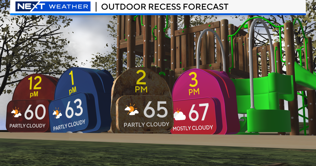
Monday - Cloudy...becoming partly sunny during the afternoon. An isolated light shower through 4 PM. Highs 64 to 68. North winds 10 to 20 mph...except winds as high as 30 mph in the city of Detroit. Chance of rain 20 percent.
Monday Night - Partly cloudy. Lows 50 to 54. North winds 5 to 15 mph.
Tuesday - Partly sunny. Highs 68 to 72. Northeast winds 5 to 15 mph.
Tuesday Night - Partly cloudy early...then becoming mostly clear. Lows 50 to 54. North winds 5 to 10 mph.
Wednesday - Partly sunny during the morning. Mostly cloudy during the afternoon. A chance of showers. Highs 70 to 74. Northeast winds 5 to 15 mph. Chance of rain 30 percent.
Wednesday Night - Mostly cloudy during the evening. Partly cloudy overnight. A chance of showers. Lows 55 to 59. Chance of rain 30 percent.
For the latest weather information, be sure to stay with WWJ Newsradio 950 during Traffic and Weather on the 8s, 24-hours a day. For the forecast, visit our Weather Page.