Flood Watch In Effect Through Wednesday Morning
DETROIT (WWJ/AP) - The National Weather Service has issued a flood watch for southeast Michigan, in effect through Wednesday morning.
A flood watch means there is a potential for flooding based on current forecasts.
The NWS says runoff from recent precipitation and snow melt will combine with additional rainfall measuring over an inch, bringing the potential for flooding.
The flood watch is active for the following counties: Bay, Genesee, Huron, Lapeer, Lenawee, Livingston, Macomb, Midland, Monroe, Oakland, Saginaw, Sanilac, Shiawassee, St. Clair, Tuscola, Washtenaw and Wayne.
Those living in areas prone to flooding should be prepared to take action should flooding develop.
Meantime, weather forecasters say many parts of Michigan will be meeting or beating high-temperature records.
NWS Meteorologist Matt Mosteiko said the Detroit area is expected to reach Tuesday's high temperature of 58 degrees set in 1914. He says the temperature Wednesday is expected to top the record of 53 for that day in 1969.
Flint, Saginaw and other areas also are expected "to make a run" at their record temperatures in the low 50s.
Mosteiko says strong south winds and a strong jet stream are bringing temperatures and precipitation more typical of the southern U.S. The weather pattern also has brought dense fog and flooding.
The winter warmth will end, however, with a cold front coming Wednesday.
Here's the local forecast from the CBS Detroit Weather Team:
Tuesday -- Overcast with rain, then thunderstorms in the afternoon. Winds from the South at 15 to 20 mph. Chance of rain 90% with rainfall amounts near 1.5 in. possible. High of 55F, low of 50F.
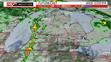
Wednesday -- Fog early. Overcast with rain, then a chance of rain in the afternoon. Winds from the SSW at 20 to 25 mph. Chance of rain 90%. High of 57F, low of 23F with a windchill as low as 12F.
Thursday -- Overcast, breezy. Winds from the West at 25 to 30 mph. High of 27F, low of 16F with a windchill as low as 3F.
Know before you go: Keep it tuned to WWJ Newsradio 950 for traffic and weather, every 10 minutes on the 8s.
Check for road construction areas and recent traffic incidents on the CBS Detroit Traffic Page. Check the extended forecast and up-to-the-minute conditions on the CBS Detroit Weather Page.
Sign up for severe weather text alerts: Text STORM to 95001
For daily weather forecast text alerts: Text FORECAST to 95001
TM and © Copyright 2013 CBS Radio Inc. and its relevant subsidiaries. CBS RADIO and EYE Logo TM and Copyright 2013 CBS Broadcasting Inc. Used under license. All Rights Reserved. This material may not be published, broadcast, rewritten, or redistributed. The Associated Press contributed to this report.