Severe Thunderstorms Leave Damage Behind, Thousands Without Power
MILFORD (WWJ) - Severe thunderstorms packing high winds knocked down trees and power lines across parts of Michigan, leaving tens of thousands of people without power.
As of late Tuesday night, about 58,000 homes and businesses are without power, according to a DTE Energy spokesman. That's down from 140,000 early Tuesday morning.
[Click here to check the DTE Energy Outage Map]
The majority of the outages were in Oakland and Wayne counties, followed by Livingston and Washtenaw counties.
DTE Energy spokesman Scott Simons said it could be some time before everyone is back online.
"The number here of 140,000 outages is still rising and until that levels off, we won't have any restoration estimates," he said.
Simons said crews will be working in 16-hour shifts around the clock to get the power turned back on.
"We're contacting other utilities and sources for additional linemen and hopefully we'll have some additional resources helping the restoration effort as well," he said. "Because it's a regional storm, it's affected four states, other utilities nearby have been impacted just like we have, so those resources will have to come from father away and could take longer to get here."
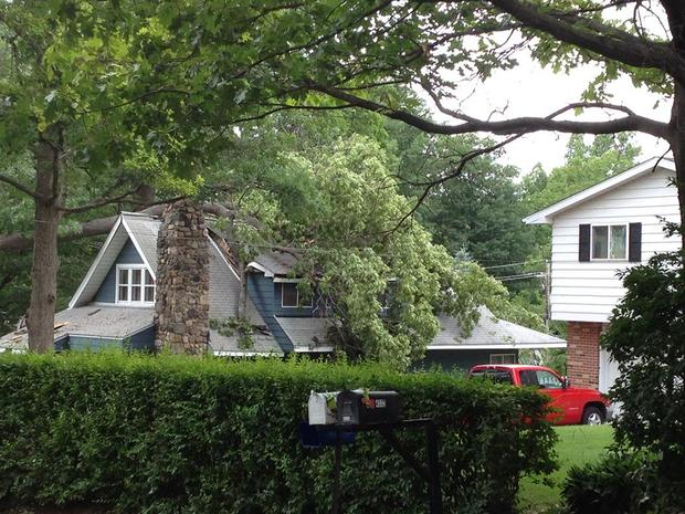
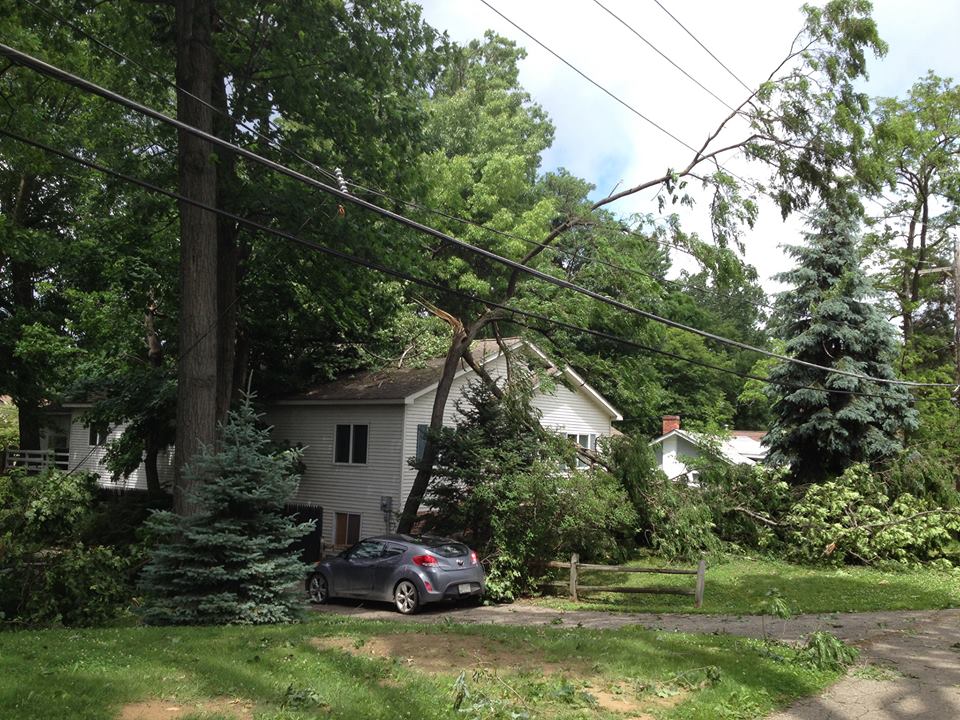
Wind gusts of up to 74 miles per hour were reported in the metro Detroit area, knocking down at least 200 power lines. Heavy rains also caused flooding on area roads and freeways.
Surveying the damage in hard-hit Waterford Township, WWJ's Sandra McNeil reported there were trees down seemingly everywhere — across lawns and fences.
Resident Jerry Burns said he was awakened by a loud noise when the storm hit.
"It was just a big crash, a big crash and then I said 'That hit something'," said Burns. "I was in the middle of sleeping, so I didn't get up...I knew it wasn't good."
As it turned out, a neighbor's tree had come down on top of his Ford pickup truck.
"The hood's damaged, the door's smashed and the front end's smashed," he said.
The vehicle may be a total loss, but Burns said he's just glad the tree didn't hit his house.

CBS 62 Chief Meteorologist Jim Madaus said the rain is over with for a bit.
"As a front comes through we will see improving conditions later tonight and especially tomorrow here in Detroit, and the rest of this week should turn out to be pretty nice," he said. "We'll have mid-to upper 80s today and your drive home from work will have lots of sunshine."
Madaus said the sunny, clear skies will stick around all week -- perfect weather for watching fireworks.
"Friday, the Fourth of July, the high is 76 degrees with sunshine, and the rest of the holiday weekend is looking pretty good," he said.
Here is the local forecast from the CBS Detroit weather team:
Tuesday: A morning shower or thunderstorm in spots; otherwise, breezy and humid with some sun returning. High 88.
Tuesday Night: Partly cloudy. Low 67.
Wednesday: Periods of clouds and sunshine with a shower; breezy. High 80.
Wednesday Night: Partly cloudy. Low 59.
Thursday: Partly sunny and cool. High 74.
Thursday Night: Clear. Low 55.
Friday: Pleasant with a full day of sunshine. High 77.
Friday Night: Clear. Low 56.
Saturday: Pleasant with sunshine. High 80.
Saturday Night: Partly cloudy. Low 60.
Know before you go: Keep it tuned to WWJ Newsradio 950 for the latest forecast during traffic and weather, every 10 minutes on the 8s.
Sign up for severe weather text alerts: Text STORM to 95001
For daily weather forecast text alerts: Text FORECAST to 95001