Winter Storm Coming Wednesday & Thursday, What To Expect
Updated 2/16/22 at 6:23 pm
We are tracking a powerful storm system that will stick around through the day today and tomorrow.
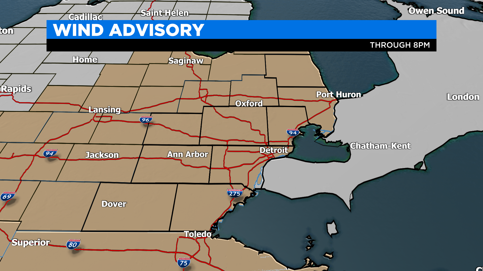
First, a WIND ADVISORY has been issued for the region due to winds gusting over mph today. If you drive a high-profile vehicle, be aware of the strong winds today as well as any power outages. Click here for the DTE power outage map. The winds are pulling in moisture and warmth from the Southeast. Temperatures are already mild in the 40s and highs today will reach the upper 40s to lower 50s.
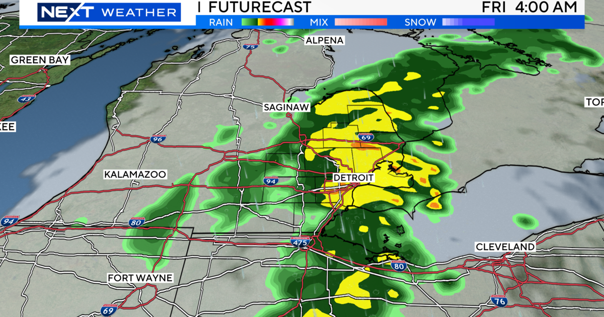
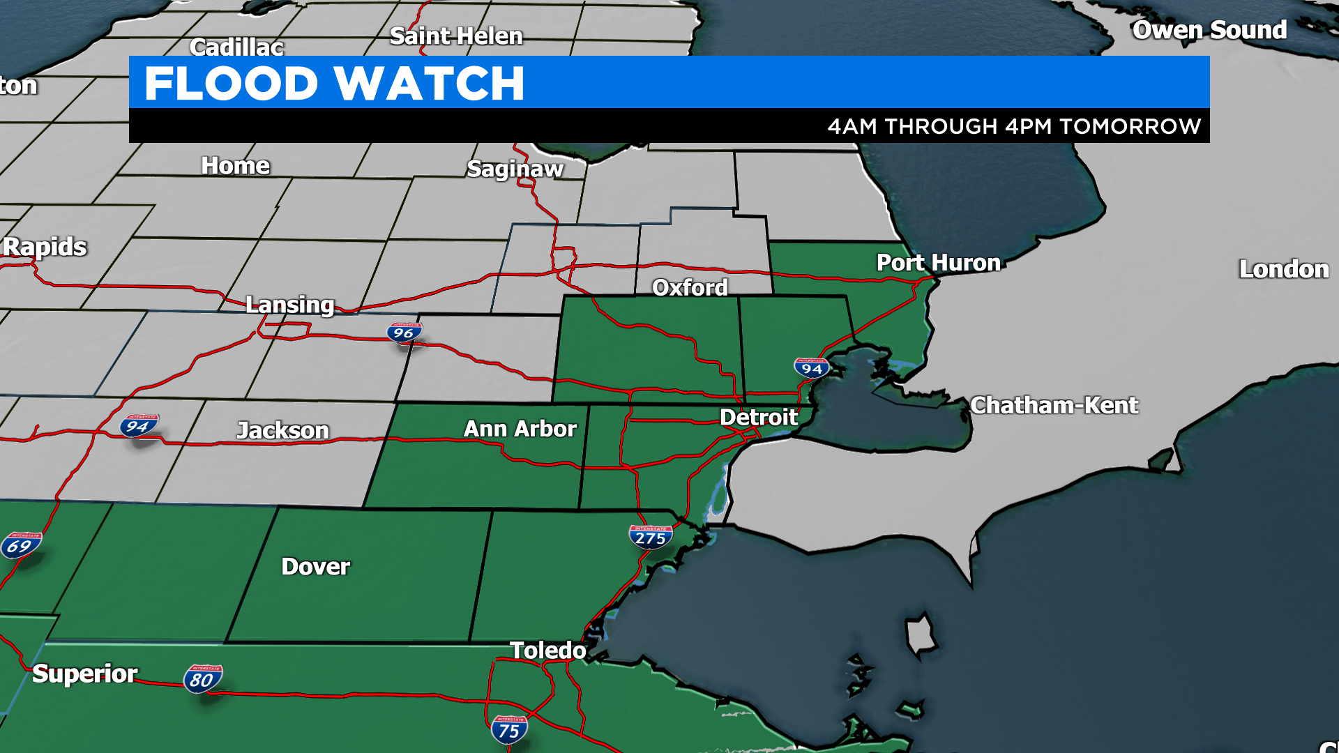
Starting this afternoon spotty rain will start to arrive across the region becoming heavier and steadier as the evening and overnight goes on. We are expecting 1" to 1.5" of rainfall. Adding in the melting snowpack and still frozen ground, flooding will be a possibility. FLOOD WATCHES will start at 4 AM tomorrow to account for this threat. However, the winds will start to relax a bit.
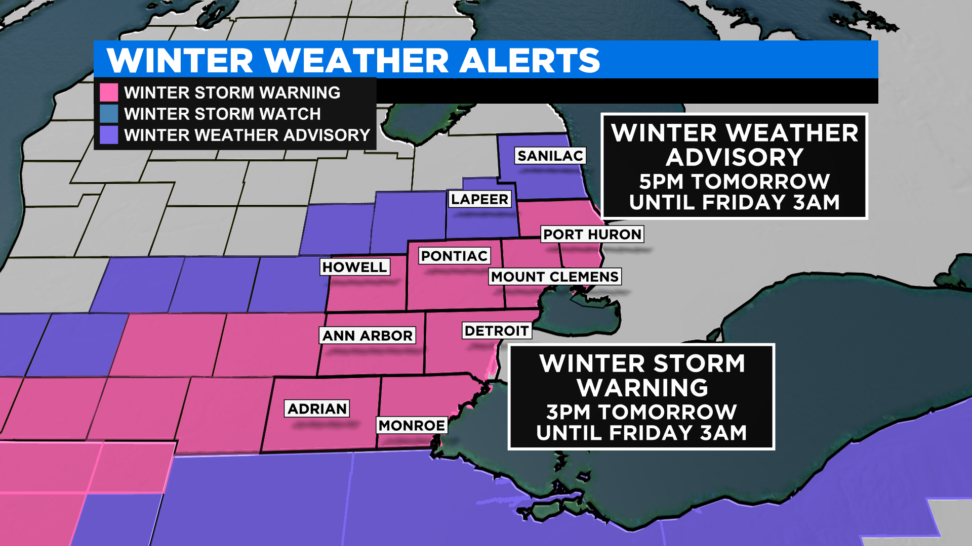
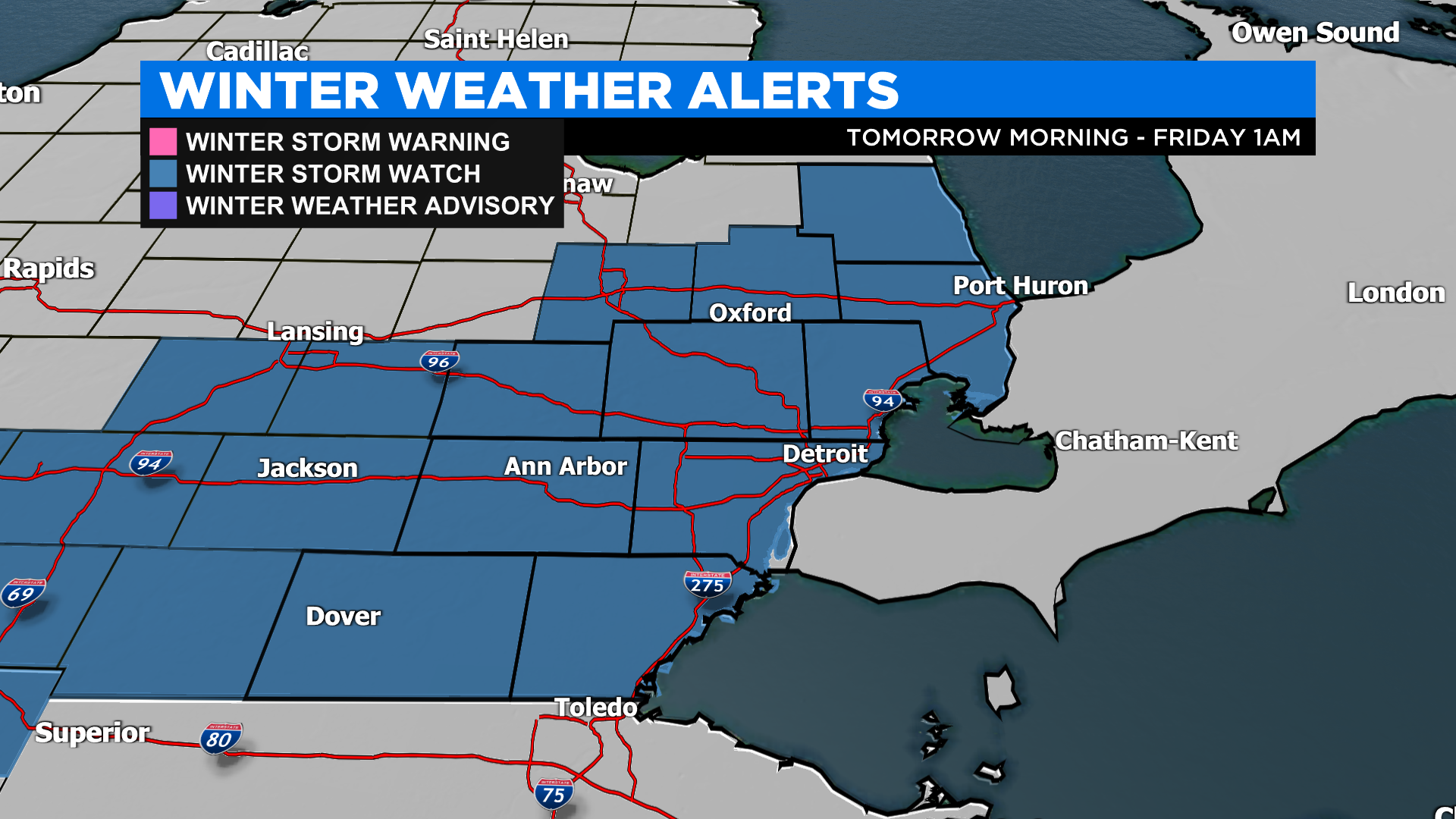
Tomorrow mid-morning, as temperatures start to fall near freezing the rain will change over to a wintry mix. Expect freezing rain and sleet. Some sleet could accumulate, and we could potentially get 0.10" of ice accumulation which will slick up roads and give us a better chance for power outages. The wintry mix is expected mainly from 8 AM tomorrow morning to 3 PM tomorrow afternoon. Lastly, a WINTER STORM ALERTS starts tomorrow through Friday morning.
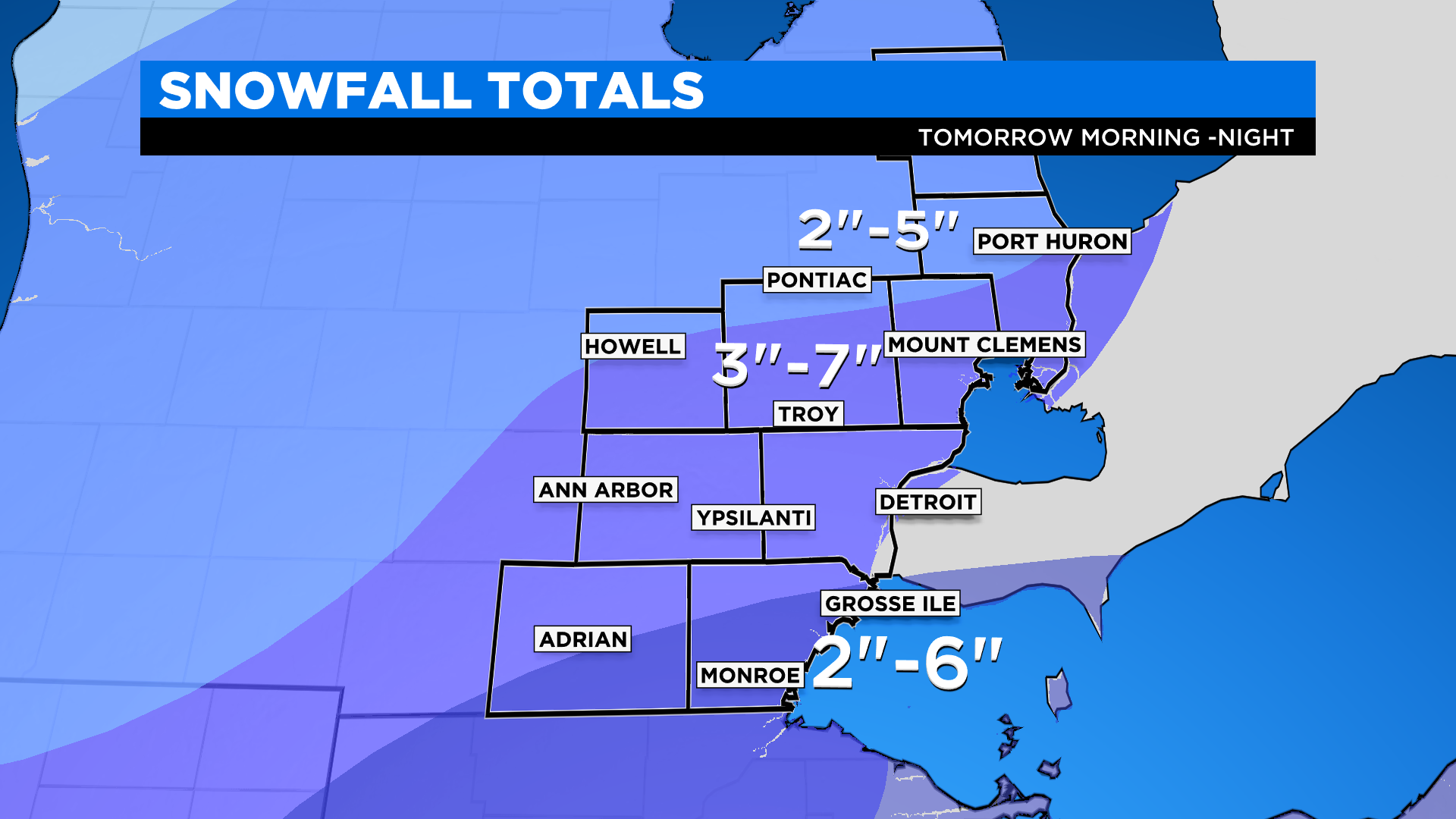
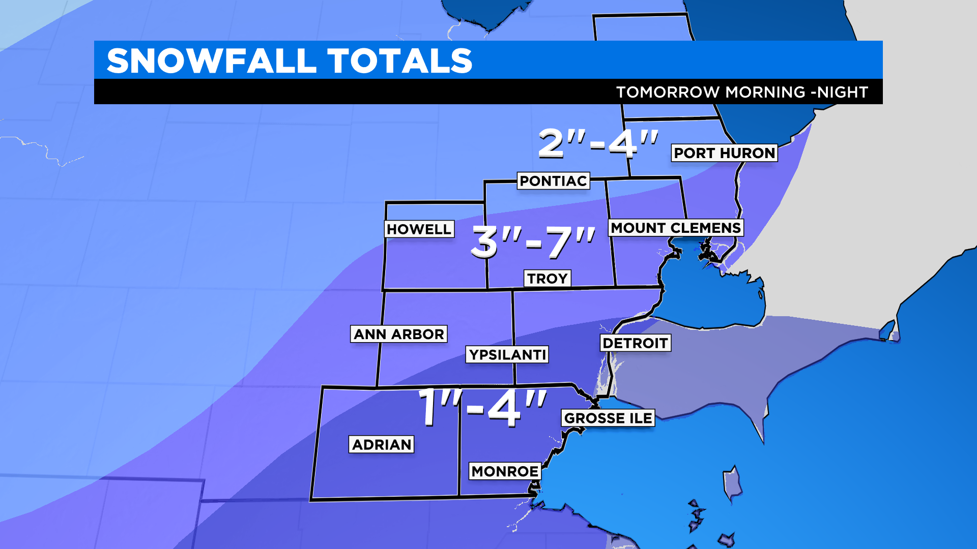
Snowfall accumulations will be generally 3" to 7" of snow, with locally higher amounts. See map below.
This forecast will change based on the path. Stay with us for additional updates and download our CBS Detroit Weather app for additional information on this storm system.
2/16/22 at 1:02 p.m.
WIND ADVISORY: For all counties through 8 pm.
FLOOD WATCH: For Lenawee, Monroe, Wayne, Washtenaw, Oakland, Macomb, and St. Clair this evening through 4 pm tomorrow.
WINTER STORM WATCH: For all counties starting tomorrow 10 AM through 1 AM Friday.
We are tracking a powerful storm system that will stick around through the day today and tomorrow.
First, a WIND ADVISORY has been issued for the region due to winds gusting over mph today. If you drive a high-profile vehicle, be aware of the strong winds today as well as any power outages. (Click here for the DTE power outage map). The winds are pulling in moisture and warmth from the Southeast. Temperatures are already mild in the 40s and highs today will reach the upper 40s to lower 50s.
Starting this afternoon spotty rain will start to arrive across the region becoming heavier and steadier as the evening and overnight goes on. We are expecting 1" to 1.5" of rainfall. Adding in the melting snowpack and still frozen ground, flooding will be a possibility. FLOOD WATCHES will start at 4 AM tomorrow to account for this threat. However, the winds will start to relax a bit.
Tomorrow mid-morning, as temperatures start to fall near freezing the rain will change over to a wintry mix. Expect freezing rain and sleet. Some sleet could accumulate, and we could potentially get 0.10" of ice accumulation which will slick up roads and give us a better chance for power outages. The wintry mix is expected mainly from 8 AM tomorrow morning to 3 PM tomorrow afternoon. Lastly, WINTER STORM WATCHES start at 10 AM through 1 AM Friday to account for this. Thursday late afternoon early evening expect widespread snow. The snow will continue through until about midnight.
Snowfall accumulations will be higher towards I-96 and less the farther south you are. Lenawee and Monroe county could see a more sleet and snow combination with 1" to 4" possible.
Sanilac and Lapeer could receive 2" to 5" of snow. Elsewhere, 3" to 7" of snow, with locally higher amounts. See map below.
This forecast will change based on the path. Stay with us for additional updates and download our CBS Detroit Weather app for additional information on this storm system.