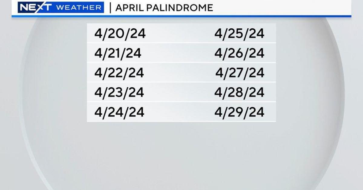
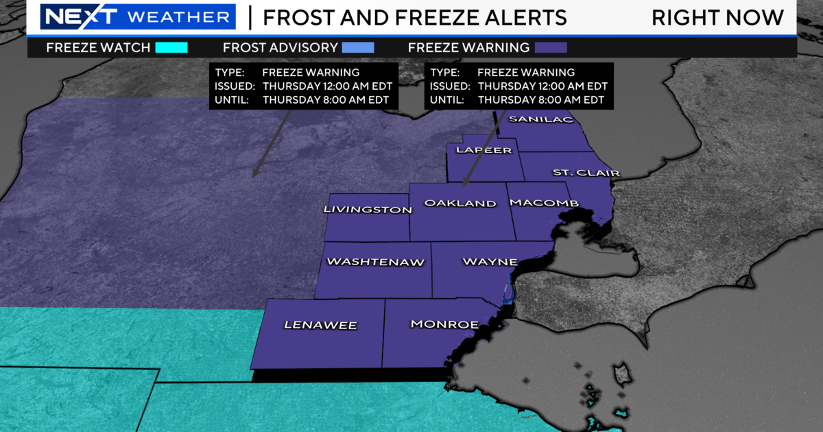
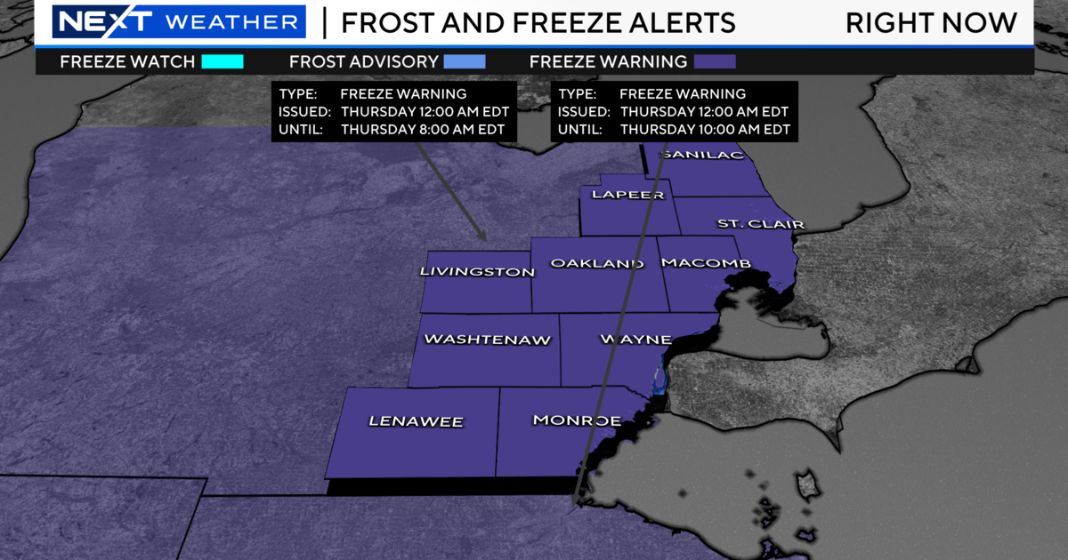
More Thunderstorms In The Forecast
SOUTHFIELD (WWJ) - Coming out of a month of near-record rainfall, there may be more summer storms on the way.
AccuWeather Meteorologist Dr. Joe Sobel said Southeast Michigan can expect clouds all day, Tuesday, with a high of 88 to 92, afternoon showers and a thunderstorm or two in spots after 3 p.m..
Then, at night, Sobel said Metro Detroiters can expect more showers and thunderstorms, with heavy rain and gusty winds possible.
Wednesday will be a bit cooler and less humid, with a slight chance of an afternoon shower, some sun and a high of 82.
Stay ahead of the storms. Keep it tuned to WWJ Newsradio 950 for the latest forecast, every 10 minutes on the 8s, 24 hours a day.
**Sign up for severe weather text alerts! Text STORM to 95001. For a daily forecast text message each morning, text FORECAST to 95001**
Forecast Details from the Weather Team:
Wednesday - Mostly cloudy early...then gradual clearing. A chance of showers through early afternoon. Highs 80 to 84. Northwest winds 10 to 15 mph...turning to north. Chance of rain 30 percent.
Wednesday Night - Clear. Lows 63 to 67. North winds 5 to 10 mph.
Thursday - Mostly sunny. Highs 84 to 88. Light and variable winds. Lows 65 to 69.
Friday - Partly sunny through mid morning...then becoming mostly cloudy. A chance of showers and thunderstorms during the afternoon. Highs 84 to 88. . A chance of showers and thunderstorms during the evening. Lows 67 to 71. Chance of rain 40 percent.
Saturday - Partly sunny...becoming mostly sunny during the afternoon. Highs 86 to 90. Lows 67 to 71.
Sunday - Mostly sunny during the morning. Partly sunny during the afternoon. A slight chance of showers and thunderstorms. Highs 87 to 91. A chance of showers and thunderstorms at night. Lows 66 to 70. Chance of rain 40 percent.