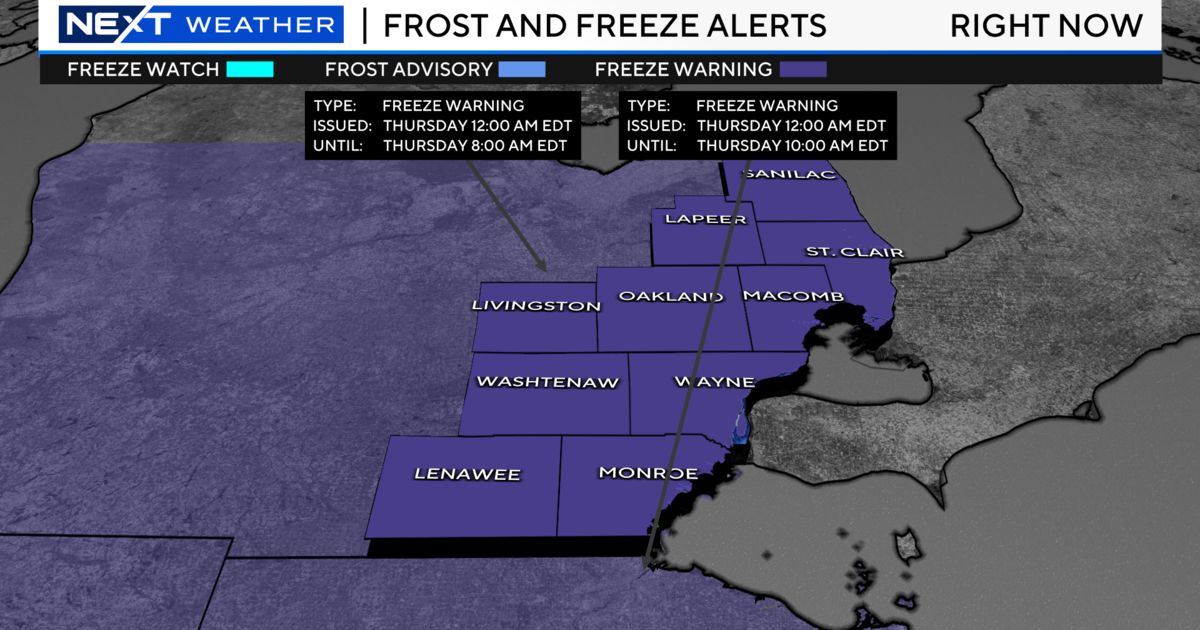
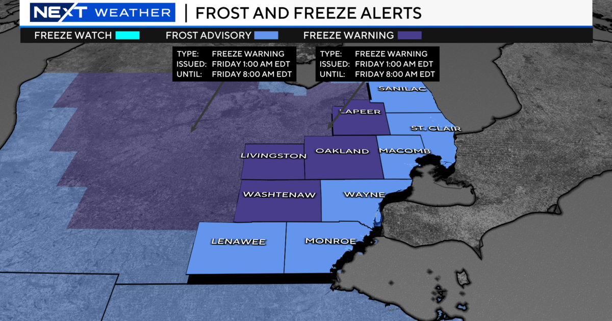
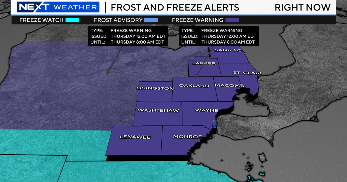
Heat Advisory In Effect Until 8 PM
SOUTHFIELD (WWJ) - The heat is on in Southeast Michigan. A Heat Advisory will be in effect until 8 p.m., Tuesday, with a high temperature expected to top 90 degrees.
Meantime, the National Weather Service has issues a severe thunderstorm watch, in effect for all of Michigan until midnight. Severe storms possible late at night could bring high winds and hail. (Details here).
The record high for this date is 95 degrees, and WWJ TV Chief Meteorologist Jim Madaus says while we probably won't break it, we may come close. Madaus says we can expect a high in the low 90s, although the heat index will make it feel like the upper 90s.
"It's all happening because a strong southerly flow from the Gulf of Mexico, bringing up hot air from the south, along with plenty of moisture increasing the humidity as well," Madaus said.
Madaus says the hot temps and high humidity will combine to create a situation where heat illnesses are possible. He reminds Metro Detroiters to drink plenty of fluids, stay out of the sun, and check on friends and relatives.
Kids and pets should never be left unattended in vehicles, Madaus added.
WWJ Newsradio 950 spoke with Dr. Jeff Ditkoff, of Beaumont Hospital Royal Oak, who said there are warning signs that you've spent too much time in the sun.
"If you're noticing that you're feeling fatigued, starting to get confused, nauseous, vomiting, anything like that, it's important to get out of the sun right away," he said.
Dr. Ditkoff said it's also important to wear at least an SPF 15 sun screen.
And while the heat is on, the electricity won't be for thousands of homes and businesses still without power following stormy weather over the weekend.
By the numbers, the worst of it remains around Battle Creek, where residents and businesses may not be able to flip the switch until sometime Thursday. They're among the more than 30,000 customers still off the grid from Monroe County, all the way over to the St. Joseph County shoreline of Lake Michigan.
Nearly 300 linemen have been on the job since this past weekend restoring power with the help of crews out of Indiana and Ohio.
DTE Energy reports about 5,000 outages remain, mostly in the Howell-Brighton area of Livingston County; 1,600 more in Ingham County; the others scattered throughout.
National Weather Service officials, by the way, confirmed there were three funnel clouds that touched down near Perry, Three Rivers and Coldwater on Sunday.
For the latest, keep it tuned to WWJ Newsradio 950 for Traffic and Weather, every 10 minutes on the 8s.
Click here for the updated weather forecast.